Nichole Ouellette

présente
Les Chenaux
Batiscan, chemin
Batiscan, chemin
Batiscan, chemin
Batiscan, chemin
Batiscan, fleuve
Batiscan, origine
Batiscan, rivière
Batiscan, rivière
Batiscanie, y vivre
Champlain
Champlain, chemin
Champlain, saisons
LaPérade, chemin
LaPérade, chemin
LaPérade, chemin
LaPérade, origine
LaPérade, fleuve
LaPérade fleuve
LaPérade, rang
LaPérade, rivière
LaPérade, rue
St-Luc-de-Vincennes
Saint-Maurice
Saint-Narcisse
St_Prosper, carte
S-Prosper, chemin
St-Prosper, enfants
St-Prosper, électrificité
Saint-Prosper, lac
Saint-Prosper, rang
Saint-Prosper, rang
Saint-Prosper, rang
Saint-Prosper, rang
Saint-Prosper, rang
Saint-Prosper, rang
Saint-Prosper, rang
Saint-Prosper, rang
Saint-Prosper, route
Saint-Prosper, route
Saint-Prosper, route
Saint-Prosper, route
Saint-Prosper, rue
Saint-Prosper, rue
St-Prosper, ruisseau
St-Prosper, ruisseau
St-Prosper, sentier
St-Stanislas, rivière
St-Stanislas, rivière
St-Stanislas, rivière
Ste-Geneviève, rang
Ste-Geneviève, rang
Ste-Geneviève, rang
Tourbière Lac-à-la-Tortue
Tourbière Lac-à-la-Tortue
Tourbière Lac-à-la-Tortue
Tourbière Lac-à-la-Tortue
Rivière Batiscan
Papier peint
Batiscan, cimetière et église

ouellette001.com
Accueil
Références - sources
Art de vivre au Québec
Infos et services
Photos choisies
Québec en photos
Racines et sentiers
Regards d'enfants
À propos
À LA UNE
|
ouellette001.com
Québec en photos
Mauricie - Les Chenaux
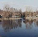
 46° 27' 05.73" N - 072° 16 55.39" O, MRC Les Chenaux
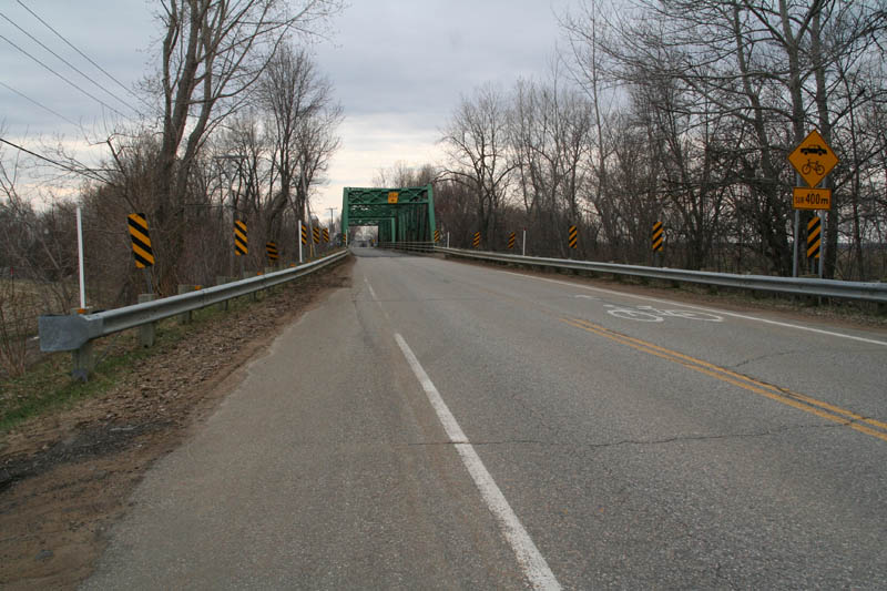
Batiscan (Municipalité), chemin du Roy (route n° 138), direction ouest, pont
de fer au-dessus de la rivière Champlain, 14:48
le mercredi 22 avril 2009, Riviere_Champlain_001_800.
|
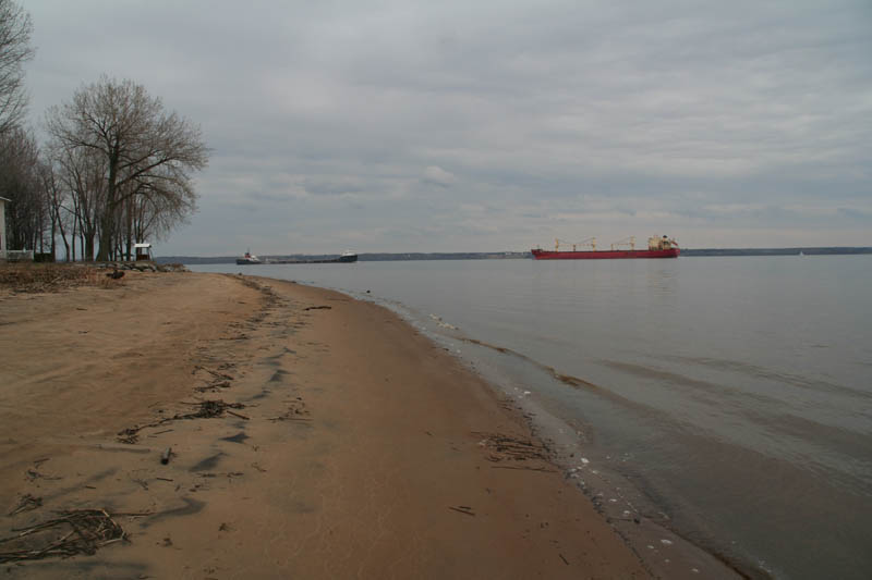
46° 26' 50.52" N - 072° 16 50.21" O, MRC Les Chenaux
Batiscan (Municipalité), plage de sable à l' embouchure de la rivière Champlain, navire dans le chenal de
la section estuarienne du fleuve Saint-Laurent,
15:01 le mercredi 22 avril 2009, Riviere_Champlain_013_800.
|
|
[ Batiscan, chemin ] [ Batiscan, chemin ] [ Batiscan, chemin ] [ Batiscan, chemin ] [ Batiscan, fleuve ] [ Batiscan, origine ] [ Batiscan, rivière ] [ Batiscan, rivière ] [ Batiscanie, y vivre ] [ Champlain ] [ Champlain, chemin ] [ Champlain, saisons ] [ LaPérade, chemin ] [ LaPérade, chemin ] [ LaPérade, chemin ] [ LaPérade, origine ] [ LaPérade, fleuve ] [ LaPérade fleuve ] [ LaPérade, rang ] [ LaPérade, rivière ] [ LaPérade, rue ] [ St-Luc-de-Vincennes ] [ Saint-Maurice ] [ Saint-Narcisse ] [ St_Prosper, carte ] [ S-Prosper, chemin ] [ St-Prosper, enfants ] [ St-Prosper, électrificité ] [ Saint-Prosper, lac ] [ Saint-Prosper, rang ] [ Saint-Prosper, rang ] [ Saint-Prosper, rang ] [ Saint-Prosper, rang ] [ Saint-Prosper, rang ] [ Saint-Prosper, rang ] [ Saint-Prosper, rang ] [ Saint-Prosper, rang ] [ Saint-Prosper, route ] [ Saint-Prosper, route ] [ Saint-Prosper, route ] [ Saint-Prosper, route ] [ Saint-Prosper, rue ] [ Saint-Prosper, rue ] [ St-Prosper, ruisseau ] [ St-Prosper, ruisseau ] [ St-Prosper, sentier ] [ St-Stanislas, rivière ] [ St-Stanislas, rivière ] [ St-Stanislas, rivière ] [ Ste-Geneviève, rang ] [ Ste-Geneviève, rang ] [ Ste-Geneviève, rang ] [ Tourbière Lac-à-la-Tortue ] [ Tourbière Lac-à-la-Tortue ] [ Tourbière Lac-à-la-Tortue ] [ Tourbière Lac-à-la-Tortue ]
[ Les Chenaux ] [ Maskinongé ] [ Mékinac ] [ Shawinigan ] [ Tourbière Lac-à-la-Tortue ] [ Tourbière Lac-à-la-Tortue ] [ Tourbière Lac-à-la-Tortue ] [ Trois-Rivières ]
|

 le samedi 25 avril 2009
le samedi 27 avril 2013- le vendredi 25 octobre 2024
constante mouvance de mes paysages intérieurs
|